
This site is privately supported reference providing information of interest to the land surveyor (also known as the Cadastral Surveyor) involved in the preservation and retracement of the Public Land Survey System (PLSS) in the United States. The term Cadastral, in the U.S., is most often associated with the Federal Land Surveying Authority. The PLSS is also known as the "rectangular system", and was a key factor in the orderly expansion west in the early history of the country.
| *Cadastral is What?
The Manual of Surveying Instructions - 1973 info etc. updated 11/19/2001 2017 Solar and Polaris Surveyors Ephemeridesupdated 01/08/2017 Papers and miscellany...updated 8/11 |
 |
Cadastral Survey is an operational program within the Bureau of Land Management, Department of the Interior whose mission and focus includes:
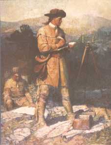
So fine, but what is Cadastral really? The term comes from Latin base term Cadastre referring to a registry of lands. So actually Cadastral Surveying is surveying having to do with determining and defining land ownership and boundaries. Seems like a pretty boring thing perhaps? Well a lot of people think surveys are relatively unimportant until they find they have located many hundreds of thousands of dollars of improvements, buildings, etc. on someone else's land. Suddenly the value of knowing where your land is comes into perspective.
The practice of finding boundaries is neither a purely legal process, nor a purely scientific process. It is something in between with a twist. The boundary surveyor in finding an old survey must be cognizant of the legal description of the land and any conflicts which may affect it. This involves not only knowledge but skills in research and investigation. Then the surveyor must be part archeologist to find physical evidence of previous surveys and occupation on the ground. Throughout the process the surveyor must understand the concepts of good measurements to find and describe what is found, and be able to interpret it's relationship to the record. In the end those that do it well find it can be rewarding and fun, sort of as mathematical detective work, with archeology, dendrology, geology and paralegal aspects thrown in. So we sometimes use the old saying "Land Surveying" is both an art and a science.

![]()
jwahl@qubicle.com